Cleaner satellite data
Compared with a phone alone, the receiver is designed to improve signal quality and make field contour logging more stable while walking or driving around the boundary.
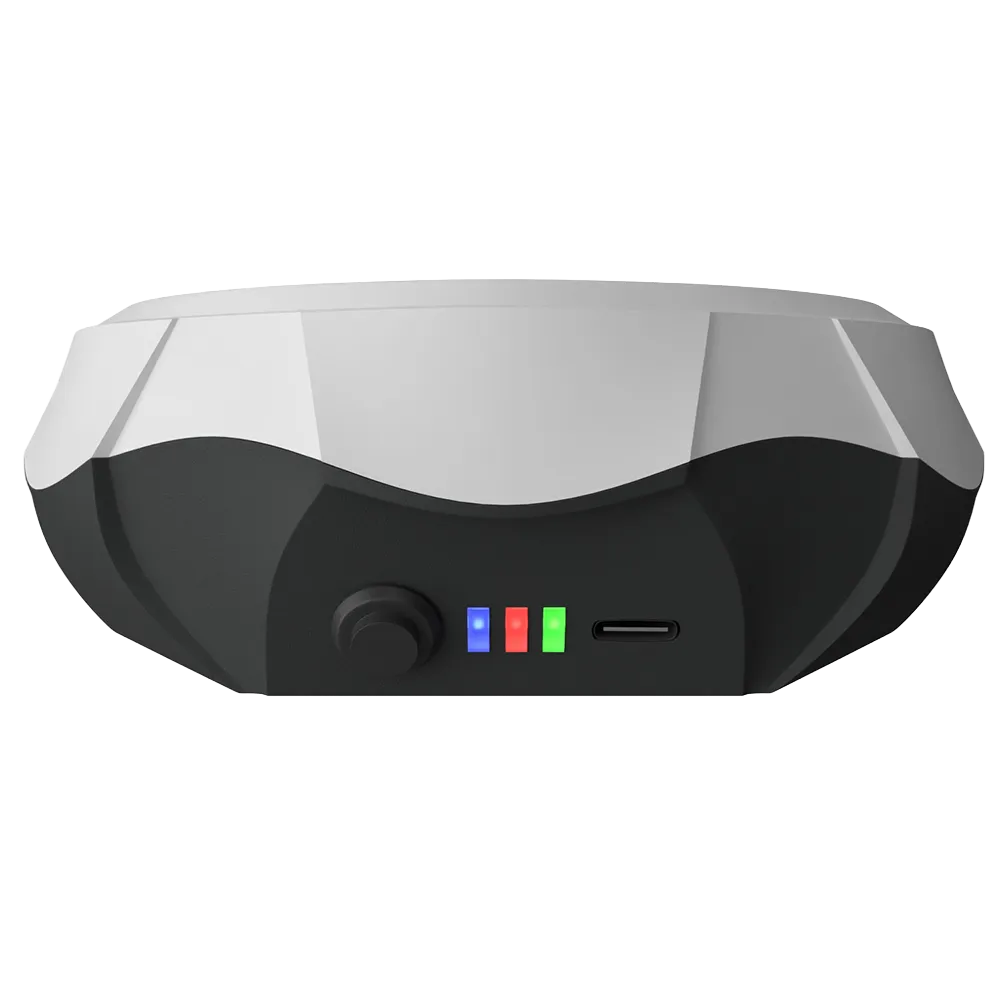
A compact Bluetooth GNSS receiver designed for farmers, agronomists and land measurement tasks where you need a cleaner signal, faster satellite lock and more reliable boundary recording than a phone or tablet alone.
Optimized for agricultural field measurement. If your project requires stakeout or cadastral-grade accuracy, explore our GNSS RTK receiver series →
GM SPIKE 2 is a practical measurement tool for agricultural field boundaries. It improves real-world positioning on Android devices by using a dedicated external GNSS receiver with a stronger antenna environment, cleaner signal handling and more stable continuous point logging along the field edge.
Compared with a phone alone, the receiver is designed to improve signal quality and make field contour logging more stable while walking or driving around the boundary.
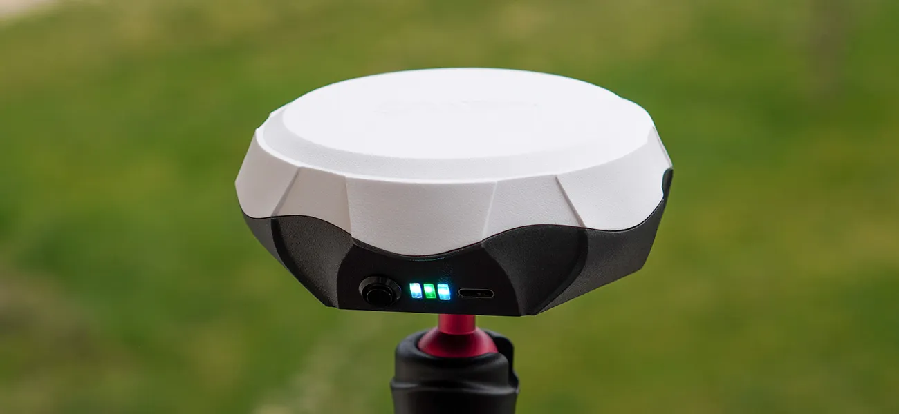
Mount it on a vehicle roof with the magnetic holder or fix it on a telescopic pole for walking measurements in narrow, irregular or obstacle-rich areas.
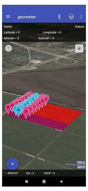
Connect by Bluetooth, open geometer SCOUT and start measuring areas, points, distances, polygons and field boundaries in one familiar workflow.
Simple workflow, fast onboarding and reliable results for routine agricultural measurements.
Pair GM SPIKE 2 with your Android phone or tablet and place the receiver on a vehicle roof or on a pole for walking measurement.
Launch the app, create a project, select the map type you need and start field measurement using the external receiver as the location source.
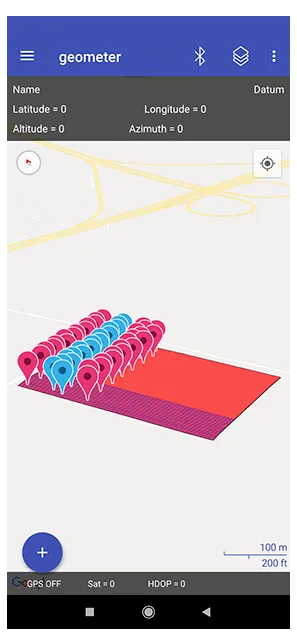
Record the real field shape in continuous mode to capture bends, turns and irregular edges more accurately than rough tap-on-map estimation.
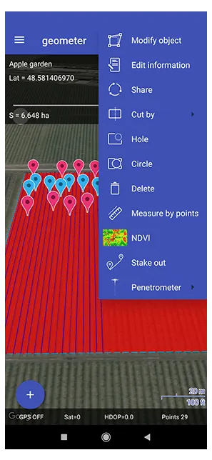
Review the polygon, split zones if needed, add notes and export the result for reporting, planning or transfer to other systems.
New housing, compact dimensions and better energy efficiency make the second generation easier to carry, easier to mount and more practical for long sessions in the field.
The system is powered by geometer SCOUT for Android — a mobile field measurement app that helps you measure, edit, organize and export map objects directly from your smartphone or tablet.
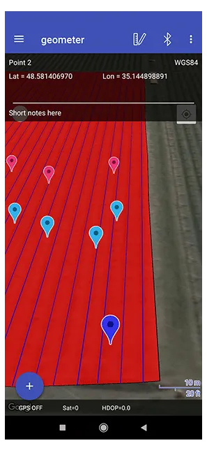
Work with coordinates, distances and polygons in one project. Use tap-on-map measurement or connect an internal or external GNSS source.
Rename objects, add notes, adjust points, change fill color, control visibility and keep field information organized in layers.
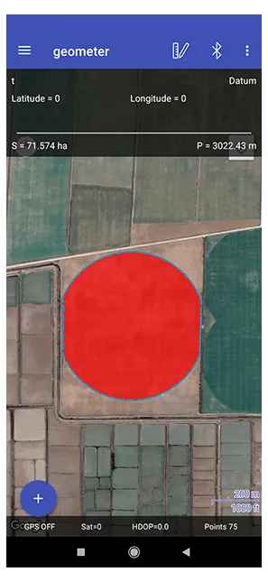
Split plots, add holes, build circular shapes, measure between objects and refine the final map directly in the field.
Enter your own coordinates, average location to improve accuracy and use the point navigation function when you need to move to a selected place.
Switch between standard, satellite, topographic and grid-style views depending on the task, terrain and visibility conditions.
Transfer projects between systems, save completed measurements and continue your workflow in office software or other mapping environments.
The value of GM SPIKE 2 is not just better positioning. It helps make day-to-day agricultural measurement faster, more repeatable and easier to document.
Capture bends, irregular borders, narrow entries and curved edges with continuous logging instead of rough visual estimation.
Dedicated external GNSS positioning gives more dependable geometry than relying only on a consumer phone in the field.
Choose the faster vehicle workflow for accessible edges or switch to the pole setup for tight spaces and complex boundaries.
Store measured plots, export files, add notes and keep consistent data for future planning and comparison.
Start with the car-ready set or choose the full walking + vehicle kit for maximum flexibility during field campaigns.
A practical entry bundle for users who usually measure field borders by driving along accessible edges.
The complete field-ready solution for customers who need flexible measurement both from a vehicle and on foot.
Browse through the screenshots to see how geometer SCOUT simplifies field measurement. From project creation to exporting KML files — every step is designed for efficiency in the field.
Geometer SCOUT is a licensed software product, with each license assigned to a single device. If you replace or lose your device, our support team can transfer your license — so your access stays with you, not with the hardware.
Learn more about geometer SCOUT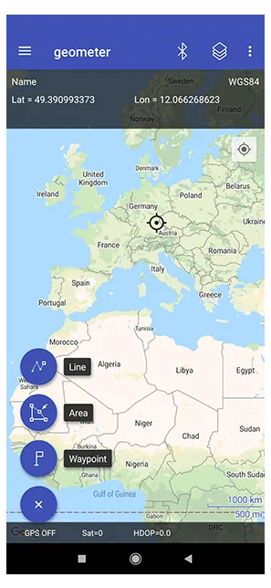
Long runtime helps cover large farms and long field days without worrying about frequent charging stops.
Switch between a vehicle-mounted workflow and a pole-based workflow depending on accessibility and field conditions.
The new brand-style housing is more impact-resistant and better adapted for practical field handling than the previous generation.
The updated electronics focus on improved energy efficiency and more practical day-long usability.
Fast start behavior helps you begin work sooner when moving between fields or restarting the device in real field conditions.
Low weight and small footprint make the receiver convenient to carry, store and move between jobs.
Get straight answers about accuracy, compatibility, and real-world performance. Whether you're comparing GM SPIKE 2 with phone-only measurements or considering an RTK system — here's what you need to know.
No. It is a dedicated GNSS receiver for improved field area measurement with Android devices. For RTK tasks such as precise stakeout or cadastral work, choose a GNSS RTK model.
Yes. GM SPIKE 2 connects to Android devices by Bluetooth and works with geometer SCOUT. The extended bundle is simply a ready-to-use option for customers who want a full kit.
The external receiver is built for cleaner satellite reception and more stable continuous measurement, which helps produce more dependable field contours than a phone alone.
Yes. The basic bundle includes a magnetic holder for mounting the receiver on a vehicle roof, which is convenient for measuring accessible field boundaries by car.
Yes. The extended bundle includes a telescopic pole and phone holder, making it more convenient to record boundaries on foot in complex areas.
Yes. geometer SCOUT supports KML import and export, helping you keep your measured field data portable and reusable.
Choose the bundle that fits your workflow and contact us for ordering, delivery details or product questions. We will help you select the right configuration for vehicle or walking measurements.
We can provide pricing, bundle details, shipping information and help you choose the most practical setup for your work.